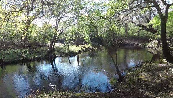
Steinhatchee
Springs Wildlife Management Area occupies 20,909 acres along the Steinhatchee River
that is owned by the Suwannee River Water Management District and jointly managed
with the Florida Fish and Wildlife Conservation Commission. The southern portion
of Steinhatchee Springs WMA - along the east bank of the Steinhatchee River in Dixie
County - is an area of 3,559 acres called the Steinhatchee Rise Tract.
The Steinhatchee River flows 35 miles from swamps in Lafayette County, through Taylor
and Dixie counties to the Gulf of Mexico. Just north of the town of Tennille, at
the south portion of the Steinhatchee Springs WMA, the river goes underground and
re-emerges about a half mile further south. The land area where the river comes
back out of the ground from under a limestone ledge is referred to as "River
Rise".
Hunting is permitted within Steinhatchee Springs Wildlife Management Area, so it's
important to check the dates for hunting seasons before venturing into the area
off the marked trails. Some trails are suitable for off-road cycling as well as
hiking. You may bring your dog on a leash. Horses must stay on the named or numbered
roads.
There are numerous access points to the Steinhatchee Rise tract. Probably the most
interesting access point is a short trail beginning along the west side of U.S.
19 just south of the Steinhatchee River bridge. The half mile long trail takes you
to a wondrous spot where the river emerges from underground. The map marker and
navigation button below will take you to that location.
The primary access route to the Steinhatchee Rise Tract is along S.W. 700th Street
(Storm Mainline Road), where there a number of entrances open to the public. Note
that this is a tract with no public facilities ... so plan accordingly.
Activities & Facilities
Dogs allowed

Short hiking trails

Long hiking trails

Mountain bike trails

Horse trails

Hunting

Fishing