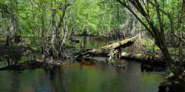
Steinhatchee Springs Wildlife Management Area occupies 20,909 acres along the
Steinhatchee River that is owned by the Suwannee River Water Management District
and jointly managed with the Florida Fish and Wildlife Conservation Commission.
The Steinhatchee River flows 35 miles from swamps in Lafayette County,
through Taylor and Dixie counties to the Gulf of Mexico. Just north of the town
of Tennille, at the south portion of the Steinhatchee Springs WMA, the river
goes underground and re-emerges about a half mile further south.

Most of the Steinhatchee Springs WMA is
located in Lafayette County ... so not technically a part of Florida's "Nature
Coast". For more details about
Steinhatchee Falls and
the
Steinhatchee Rise Tracts - which are in
Taylor and Dixie counties in the south portion of Steinhatchee Springs WMA, see the
article devoted to those tracts.
Hunting is permitted within Steinhatchee Springs Wildlife Management Area, so
it's important to check the dates for hunting seasons before venturing into the
area off the marked trails. Some trails are suitable for off-road cycling as
well as hiking. You may bring your dog on a leash. Horses must stay on the named
or numbered roads.
There are numerous access points to the Steinhatchee Wildlife Management Area,
primarily along SR51 between Mayo and Tennile. Other points of entry are
available along CR357 and L.A. Bennett Grade in Lafayette County. Note that this
wildlife management area is considered to be a "primitive tract" ... so there is
no official visitor center. Our map and "Navigate" button below will take you
one spot just north of Tennille where you can drive along a dirt road to the
river. This access point, like many of the others, is an ungraded dirt/shell
road (sometimes referred to as a "two-trail") that may not be suitable for all
vehicles.
Activities & Facilities
Picnic shelter

Dogs allowed

Short hiking trails

Long hiking trails

Mountain bike trails

Horse trails

River or lake kayaking

Hunting

Fishing